
Formation of Mississippi Counties
- Profile
- Images
Location: [unknown]
| ... ... ... is a part of Mississippi history. Join: Mississippi Project Discuss: Mississippi |
April 1798
The Natchez District was claimed by the U.S. in 1798. In April of that year, the U.S. created the Mississippi Territory, with Natchez as its first capital.
The French explorer Pierre Le Moyne d'Iberville had passed through the area in 1699 and had christened both the Amité and the Tangipahoa rivers. In 1774, Britain extended the borders of its West Florida colony (gained after the Seven Years' War) from the 31st parallel north to 32° 22′ north, in part to give colonists access to the fertile Natchez District. By 1776, a sizable colony of English-speaking Loyalist planters had settled there.

|
| Natchez District. |
After the American Revolutionary War, via a treaty with Spain (which had regained West Florida from Britain), the United States acquired the Natchez District.
- ADAMS, 1799, The Natchez District;
- WILKINSON, 1802
- AMITE, 1809
- FRANKLIN 1809
- JEFFERSON,1799 Natchez District (AKA Pinckney County)
- CLAIBORNE, 1802
- WARREN, 1809 Natchez District
December 17, 1801
The Treaty of Fort Adams was signed on December 17, 1801 between the Choctaw and the United States Government. The treaty ceded about 2,641,920 acres of Choctaw land. The treaty was originally designed for the creation of the Natchez Trace
November 16, 1805
The Treaty of Mount Dexter was signed between the United States and the Choctaws. The treaty was signed November 16, 1805. The 4,142,720-acre area ceded was from the Natchez District to the Tombigbee Alabama River watershed, mostly in present-day Mississippi.[1]
- WAYNE, 1809 created from Washington Alabama
- GREENE, 1811,
- MARION, 1811
- LAWRENCE, 1814
- PIKE, 1815
- COVINGTON, 1819, Created from Lawrence and Wayne. Bainbridge County, Mississippi, was formed January 17, 1823, the county was dissolved by an act dated January 21, 1824
- JONES name changed to Davis, then back to Jones in 1868
1812 Counties created from Mobile District, Spanish West Florida
- HANCOCK, 1812, Mobile District
- HARRISON, 1841
- PEARL RIVER, 1872
- JACKSON], 1812, Mobile District
1816 Chickasaw Cession
- MONROE, 1821, Monroe County was created 9 February 1821 from the 1816 Chickasaw Cession.
- LOWNDES, 1830
1817Mississippi admitted to the Union as a State.
October 18, 1820
'The Treaty of Doak's Stand' was signed on October 18, 1820 (proclaimed on January 8, 1821) between the United States and the Choctaw Indian tribe. Based on the terms of the accord, the Choctaw agreed to give up approximately one-half of their remaining Choctaw homeland.[2]
- HINDS, 1821
- RANKIN was created 4 February 1828 from Hinds County
- COPIAH, created 21 January 1823 from Hinds County
- SIMPSON, 1824, Formed from Copiah
- WASHINGTON,1827, Formed from Warren and Yazoo
- MADISON, 1828 Formed from Yazoo
September 27, 1830
The Treaty of Dancing Rabbit Creek was a treaty signed on September 27, 1830 (and proclaimed on February 24, 1831) between the Choctaw and the United States Government. This was the first removal treaty carried into effect under the Indian Removal Act. The treaty ceded about 11 million acres of the Choctaw Nation (now Mississippi) in exchange for about 15 million acres in the Indian territory (now the state of Oklahoma).[3]

|
Non- County (Choctaw) Lands were attached to MADISON,MONROE, WASHINGTON,WAYNE, YAZOO, RANKIN, and SIMPSON
- ATTALA,1833, from Madison, (Choctaw Cession)
- JASPER,1833 from Jones and Wayne, (Choctaw Cession)
- CARROLL, 1833 from Lowndes and Monroe, (Choctaw Cession)
- HOLMES , 1833, from Yazoo, (Choctaw Cession)
- CHOCTAW, 1833 From Lowndes, Madison, Monroe and Yazoo Counties,(Choctaw Cession)
- CLARK, 1833 from Wayne, (Choctaw Cession)
- LAUDERDALE, 1833 From Wayne and Rankin, (Choctaw Cession)
- LEAKE, 1833, from Madison and Rankin, (Choctaw Cession)
- NESHOBA, 1833, From Jones, Madison, Rankin and Wayne Counties,(Choctaw Cession)
- NOXUBEE, 1833 from Lowndes and Rankin Counties, (Choctaw Cession)
- OKTIBBEHA, 1833 from Lourdes, (Choctaw Cession)
- SCOTT, 1833 from Covington, Jones and Rankin Counties, (Choctaw Cession)
- SMITH, 1833, from Covington, Jones and Rankin CountiES,(Choctaw Cession)
- TALLAHATCHIE County was created 23 December 1833 from the Choctaw Cession
- WINSTON, 1833 from Lowndes, Rankin, and Wayne Counties , (Choctaw Cession)
- YALOBUSHA, 1833, Monroe, Washington and Yazoo Counties, (Choctaw Cession)
1832
Treaty with the Chickasaw, 1832. Ceded lands ( 6,422,400 acre) east of the Mississippi River and provide protection for the 'weak' tribe
1836
- BOLIVAR 1836 from Tallahatchie and Washington Counties
- CHICKASAW 1836 from Monroe County and Chickasaw Cession
- COAHOMA 1836 from Chickasaw Cession
- DESOTO 1836 from Chickasaw Lands
- ITAWAMBA 1836 from Monroe County and the Chickasaw Cession
- LAFAYETTE 1836 from Monroe County and the Chickasaw Cession
- MARSHALL 1836 from Monroe County and the Chickasaw Cession.
- NEWTON 1836 from Neshoba County
- PANOLA 1836 from Monroe and Washington Counties
- PONTOTOC 1836 from Monroe County and the Chickasaw Cession
- TIPPAH 1836 from Monroe County and the Chickasaw Cession
- TISHOMINGO 1836 Monroe County and the Chickasaw Cession
- TUNICA 1836 Washington County and the Chickasaw Cession

|
1844
- ISSAQUENA 1844 created from Washington County
- SUNFLOWER, 1844 created from Bolivar County and Washington Counties
1852
- CALHOUN, 1852, created from Chickasaw, Lafayette and Yalobusha Counties
1866
- LEE, 1866, created from Itawamba and Pontotoc Counties
1870
- ALCORN, Alcorn County was created 15 April 1870 from Tippah and Tishomingo Counties.
- UNION created 7 July 1870 from Pontotoc and Tippah Counties
1871
- LEFLORE, 1871, created from Carroll and Sunflower Counties
- COLEFAX now CLAY 1871, name changed to CLAY in 1876. Created from Chickasaw, Lowndes, Monroe and Oktibbeha Counties.
- MONTGOMERY, 187, created from Carroll and Choctaw Counties
1873
- TATE, 1873 formed from DeSoto, Marshall, Tunica and Marshall County
1876
- SHARKEY, 1876, from Issaquena, Warren and Washington Counties
1877
- QUITMAN, 1877, carved out of Coahoma, Panola, Tallahatchie and Tunica Counties
1882 SUMNER name changed to WEBSTER, was created 6 April 1874 from Montgomery, Chickasaw, Choctaw and Oktibbeha Counties.

|
1890
- PEARL RIVER, 1890 Hancock and Marion Counties
1904
- LAMAR, 1904, created Marion and Pearl River Counties
1906
FORREST 1906, created from Perry County JEFFERSON DAVIS was created 31 March 1906 from Covington and Lawrence Counties
1912
WALTHALL, 1912, created from Marion and Pike Counties
1916
STONE, 1916, created from Harrison County.
1918
HUMPHREYS , 1918, created from Holmes, Sunflower, Washington and Yazoo Counties

|
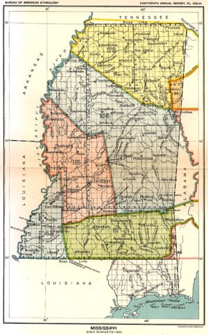
| Map of Mississippi county boundaries and county seats. |
Bibliography
List of Mississippi Counties with Burned Courthouses
- Alcorn County Courthouse – Corinth – Record Loss in 1917
- Attala County Courthouse – Kosciusko – 1858, 1860 and 1896
- Bolivar County Courthouse – Rosedale and Cleveland – Fire in 1863, Flood in 1865
- Calhoun County Courthouse – Pittsboro – Fire in 1922
- Chickasaw County Courthouse – Houston – Fire in 1863
- Choctaw County Courthouse – Ackerman – Fire 1874, 1888
- Covington County Courthouse – Collins – Record loss in 1904
- Desoto County Courthouse – Hernando – Record loss in 1940
- Franklin County Courthouse – Meadville – Fire in 1877
- Greene County Courthouse – Leakesville – Fire in 1875
- Holmes County Courthouse – A courthouse fire in 1884 destroyed many of the records, but the deeds were housed in a separate building and Will Book I was rescued.
- Jackson County Courthouse – Pascagoula – Fire in 1875
- Jefferson County Courthouse – Fayette – Record loss in 1904, Fire in 1990
- Jones County Courthouse – Laurel and Ellisville – Unknown Date
- Kemper County Courthouse – DeKalb – Fire in 1882
- Lee County Courthouse – Tupelo – Fire in 1873 & 1904
- Lincoln County Courthouse – Brookhaven – Unknown 1893
- Montgomery County Courthouse – Winona – Record loss, 1903.
- Newton County Courthouse – Decatur – Record loss, 1877 and 1910.
- Oktibbeha County Courthouse – Starkville – Record loss, 1880.
- Panola County Courthouse – Sardis – Record loss, 1886
- Perry County Courthouse – New Augusta – Record loss, 1877
- Pike County Courthouse – Magnolia – Record loss, 1882
- Prentiss County Courthouse – Booneville – Record loss, 1912.
- Simpson County Courthouse – Mendenhall – Record loss, 1840, 1872
- Smith County Courthouse – Raleigh – Record loss, 1892, 1915
- Sunflower County Courthouse – Indianola – Record loss, 1870.
- Tallahatchie County Courthouse – Charleston/Sumner – Record loss at Sumner, 1908
- Tippah County Courthouse – Ripley – Record loss, 1863
- Union County Courthouse – New Albany – Record loss, 1882
- Wayne County Courthouse – Waynesboro – Record loss, 1892

- Login to edit this profile and add images.
- Private Messages: Send a private message to the Profile Manager. (Best when privacy is an issue.)
- Public Comments: Login to post. (Best for messages specifically directed to those editing this profile. Limit 20 per day.)