
Burleson County, Texas
- Profile
- Images
Location: [unknown]
Surnames/tags: burleson_county, Texas us_history
| ... ... ... is a part of Texas history. Join: Texas Project Discuss: Texas |

- Texas Space Page
- The current leader of this project is: Mary Richardson.
Contents |
History/Timeline
Formed:
- 1846 Burleson County was created from Milam and Washington Counties, with Caldwell, Texas as county seat. Named in honor of Gen. Edward Burleson, War of 1812, (Perkin's Regiment, AL), San Jacinto, Indian Wars veteran, Republic of Texas vice-president, senator and signer of The Texas Declaration of Independence.

|
| Burleson co. seal |
1744 Tonkawa Indians may have descended from Archaic, Neo-American peoples (7000 b.c.-500 a.d.) then disappeared due to European diseases. Stone artifacts and ceramics were unearthed in mid-1960s. Caddo Indians from East Texas roved near Colorado River hunting buffalo. Wichita people, Tawakonis, and Wacos hunted here, and were hostile, raiding settlements, hunting horses. [1]
1807 - explorer Zebulon M. Pike, traveled on the Old San Antonio Road to Natchitoches after release from prison in Chihuahua.[1]
1820 -Moses Austin crossed Burleson area on the Upper Road from Arkansas to San Antonio de Béxar seeking an empresario contract in the fall of 1820.[1]
1825 -Stephen F Austin's first colony began near here, settlers arrived and lived off wild game. North of the El Camino Real was Sterling Robertson's Robertson colony, and south was the colony of Stephen F Austin. [1]
1830 As part of Mexico's intent to slow down immigration from the USA into Texas after passing its 1830 Mexican Law, Ft Tenoxtitian was built (1 of 3 forts built by Mexican government). Lt. Col Ruiz sent 100 cavalrymen from the Alamo de Paris, to build this fort near the halfway point of the El Camino Real (king's Highway). Mier had grandiose ideas for it to be the capital of Texas. With the location, it guarded the El Camino Real (king's Highway) built near the crossing where the Brazos River basin. Mier issued instructions for the design, but were ignored and most likely log construction. [2][3]
1830 Mexican government's Law of April 6, 1830, prohibited Anglo settlement in Texas. Lt. Col. José Francisco Ruiz allowed 50 Tennesseans led by Sterling C. Robertson to settle near the fort, Nov, 1830. Robertson was trying to get his impresario contract awarded to his Nashville Company earlier. [1]
1831 Francis Smith had established a general store in the community.
July, 1832 Mier y Teran realized his capital of Texas was not to happen and committed suicide. This left Col. Ruiz with his troops, which he decided to abandon the Tenoxtitlán garrison and return to Bexar Colony. After this the area was left with Anglo and Mexican settlers.. A trading post and settlement remained but disappeared by 1860. [1]

|
| Fort Tenoxtitlan marker |
Dec 1833 -Gabriel Jackson, KY established a large plantation in the Brazos bottoms of Burleson County, with 100 slaves. [1]
1834 Robertson opened a land office in Tenoxtitlán and began issuing patents to land north of the Old San Antonio Road.[1]
Mar, 1836 - residents of the area joined the mass flight from the advancing Mexican army following the fall of the Alamo, (the Runaway Scrape).[1]
1837 - William Oldham had purchased Arnolds property. Home of the black settlement on the large estate of Oldham, known as the "Free Settlement", home to free blacks (including Oldham's 7 children by a slave mistress).[1]
1840 Civil Engineer George B Erath platted the town of Caldwell, naming it for "Old Paint", Matthew Caldwell on Old Road, El Camino Real. American Indians were expelled from Texas. [2]
May 1841 - as settlers became more numerous, Indian raids increased..Tenoxtitlán itself was a target, until the last fatal raid.
1846, Erath introduced in First Legislature of State of Texas a bill creating Burleson County out of land of Milam and Washington counties. Burleson County was created from Milam and Washington Counties, with Caldwell, Texas as county seat. Named in honor of Gen. Edward Burleson, War of 1812, (Perkin's Regiment, AL), San Jacinto, Indian Wars veteran, Republic of Texas vice-president, senator and signer of The Texas Declaration of Independence.[2]

|
| Early Caldwell |
1850s, 60s - white population tripled in this period to 3,797, while the slave population quadrupled, to 2,003. [1]
pre 1865 Plantation system prevailed until Civil War (1861-1865). Only 23,838 acres had been improved. The prevailing high ratio of oxen to mules, 2,031 to 456, shows farmers still used the plow. [2]
1862-65 Civil War - During the Civil War, furnished hundreds of troops, cotton, food to Confederate Texas. State military units were First, Second, Third, Fifth, and Seventeenth Texas Infantry regiments, the Eighth Texas Cavalry, and Waul's Legion. To circumvent the Union Navy's blockade of the Texas coast, planters transported cotton to Mexico in trains of ox wagons.[1][2]
1866-70s Reconstruction was violent, with veterans who became outlaws rather than resume a peaceful life. The outlaws became cattle rustlers, thieves along the Yegua, such as notorious Sam Bass and his gang.[1]

|
| Sam Bass Gang |
1874 -Burleson lost 31% of area when Lee County was created.[2][1]
1870s, 80s A Ku Klux Klan cell formed with night-riding and intimidation acts aimed at freedmen.[1]
1880 Gulf, Colorado & Santa Fe Railway andHouston & Texas Central ebuilt into county[2]
'World War I - Northern industrial jobs began to open for blacks; many began to leave Burleson Co.
https://tshaonline.org/handbook/online/articles/hcb18
1970's- 1980's Oil was drilled in Burleson county in the Giddings Field found on the Austin Chalk oil pool in the 1970s that continued into the 1980s.[4]
Caldwell

|
| Burleson Co. Courthouse in Caldwell. |
1840 Caldwell was made the county seat by Republic of Texas Congress. Texas Congress annexed all of Washington County north of Yegua Creek to Milam County. The proposed town was surveyed by George B. Erath and named for Mathew Caldwell, was laid out parallel to the Old San Antonio Road. Caldwell served as the county seat of Milam County until Burleson County came into being in 1846.
The town had a population of 300 prior to the Civil War and it's prosperity was reflected in its brick courthouse. During Reconstruction, a company of State Police was stationed in Caldwell. Postwar Caldwell had its own newspaper, bottling works and ice plant. The Gulf, Colorado and Santa Fe Railway built through in 1880 and in 1905 six passenger trains arrived daily. In 1882, the first tax supported public school was built.
Company E of the Texas National Guard, was headquartered in Caldwell, part of the Thirty-sixth Infantry Division. Many soldiers of this unit were captured at Salerno, Italy, in 1943 and were POWs until the war's end. http://www.texasescapes.com/CentralTexasTownsSouth/Caldwell-Texas.htm
Government Offices
Burleson County has had four courthouses: 1846-7, 1850 ca, 1889-90 and 1927[5]
1st Courthouse, 1846-47 was brick [5]
2nd Courthouse ca 1850
3rd Courthouse, 1889-90 The image is a drawing hanging near the judge's office. It is at least 2 stories, [5]ornate.

|
| 1889 Courthouse. |
|
|
| Burleson Co Courthouse |

|
| 1927 Courthouse. |
4th Courthouse, 1927 This is style: classical Revival, with Material of Brick and concrete. It has 1st floor main lobby with colorful, detailed ceiling molding and an opening looking up into the top floor skylight. Its floor has colorful inlay tile depicting the Burleson County Seal.[5]
Geography
Burleson Cointy is in East central Texas, 45 miles East of the State Capital at Austin.
https://tshaonline.org/handbook/online/articles/hcb18
- Caldwell, the largest town and the county seat, is 60 miles E of Austin.
- Center lies at approximately 30°30' north latitude and 96°36' west longitude. State Highway 36 is the major north-south thoroughfare, and State Highway 21 spans the county east to west.
- Size -668 square miles in the Post Oak Belt region of Texas.
- Topography -undulating to hilly terrain except for broad alluvial valley along on E border
- Elevation 225 feet in SE to 475 feet in NW above sea level.
- Rivers, Creeks - Brazos River, on E border. Yegua Creek, and E Yegua Creek drain W & S reaches of the county are drained by Yegua Creek and East Yegua Creek, which drain into Brazos R in SE corner.
- Lake - Somerville Lake, 11,160 acre reservoir on Yegua Cr.
- Soil - 1/2 county has grayish-brown sandy loam and clayey subsoils, while the Brazos bottoms, on E border are reddish loamy to clayey, alluvial soils.
- San Antonio Prairie, a strip of open grassland 1-4miles in width through the middle of the county from SW to NE has dark, loamy to clayey, blackland soils with stiff clayey subsoils.
- Vegetation Post Oak Savannah Vegetation zone, with post oak forest, mosaic grassland, woods of post With the exception of this band of almost treeless Blackland Prairie.
- Post Oak Savannah vegetation zone, post oaks, hardwood forests cover 3/7 area-- blackjack oak, hickory, elm, and hackberry. Streams - water oak, pecan, and walnut.
- Bottomlands - Peat bogs and marshes abound in the bottomlands and bluestem, Indian grass, tall bunchgrass, and buffalo grass.
Prime Farmland - 21 and 30% is classified as prime farmland
- Fault Zone - Luling Fault Zone, recently a focus of intensive oil exploration. Large, newly tapped reserves of petroleum and natural gas and considerable deposits of lignite coal
- Fauna- bear, alligator, and buffalo that once roamed the area disappeared in 1800s, now white-tailed deer, coyotes, skunks, raccoons, and opossums, and mourning dove, bobwhite quail wild birds as the mourning dove and bobwhite quail in the Somerville State Wildlife Management Area.
- Temperatures high of 95° in July to an average low of 39° in January.
- Rainfall 37 inches annually. Relative humidity is 84 percent at 6 a.m. and 54 percent at 6 p.m.
- Growing season averages 268 days a year.
https://tshaonline.org/handbook/online/articles/hcb18*

|
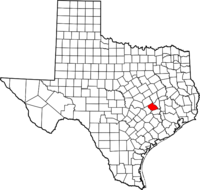
| Location in Texas |
Formed From
- Burleson County was created 15 January 1842 from Milam and Washington Counties.
Adjacent counties
- Brazos

|
| Here's an image. |
- Lee
- Milam
- Robertson
- Washington
Local Resources
- Petroleum
- Natural gas
- lignite coal
Protected Areas
- Somerville State Wildlife Management Area is haven for wild birds as the mourning dove and bobwhite quail
Demographics
Burleson County is part of the College Station-Bryan, TX Metropolitan Statistical Area.
975 to 1995, the Burleson county judge, who presides over the commissioner's court, were the son and father team of Mark Steglich Caperton (born 1946), a Caldwell attorney, and Woods Allen Caperton (1920-2009). Mark Caperton was the judge from 1975 to 1983 and was succeeded by his father, a former agent of the United States Soil Conservation Service. Woods Caperton also served seventeen years as a member of the Caldwell Independent School District and was a member too of the Burleson County Hospital District. During his time on each board, a new high school and hospital were begun. Woods Caperton was also chairman of the Brazos Valley Development Council and the Brazos Valley Mental Health Mental Retardation Center. He founded the Caldwell Cub Scouts and was instrumental in the development of the Caldwell Little League. Another son, Kent Caperton, served from 1981 to 1991 as the District 5 state senator. Kent Caperton, formerly of Bryan, is a lobbyist and lawyer in Austin.[6]
In 2000, there were 16,470 people residing in the county with a population density of 25 people/sq. mi. The racial makeup of the county was 74.07% White, 15.06% Black or African American, 0.50% Native American, 0.17% Asian, 0.02% Pacific Islander, 8.25% from other races, and 1.92% from two or more races. 14.64% of the population were Hispanic or Latino of any race. 18.8% were of German, 11.3% American, 10.7% Czech and 6.2% Irish ancestry according to Census 2000. Median income for a household in the county was $33,026, and the median income for a family was $39,385. The per capita income for the county was $16,616. About 13.20% of families and 17.20% of the population were below the poverty line, including 22.90% of those under age 18 and 14.30% of those age 65 or over.[7]
- Economy is based on farming, oil, and miscellaneous products. (1970)
- The county is served by two major railways, the Union Pacific and Burlington Northern Santa Fe.
Highways
- Texas State Highway 21
- Texas State Highway 36
Cities
- Caldwell (county seat)
- Snook (511)
- Somerville
Communities
| Communities | Communities | Communities | Communities |
|---|---|---|---|
| *Birch | *Deanville | *Hix | *Scofield |
| *Chriesman | *Frenstat | *Hogg | *Rita |
| *Clay | *Goodwill | *Lyons | *Wilcox |
| *Cooks Point | *Gus | *Merle | *Tunis |
| *Davidson | *Harmony | *NewTabor |
Things to do/See
- The Annual Kolache Festival, Second Saturday in September, On the Square Downtown
Nearby Destinations:
- Lake Somerville - recreation, tourism revenue, and much-needed flood protection for the residents of Burleson County.
Schools

|
County Resources
- Burleson County Courthouse
- Burleson County Czech Heritage Museum, corner of Shaw and Fawn Street, Caldwell Texas.
- Kraitcher House Museum, East Buck Street, Caldwell Texas.
- Burleson County Historical Museum, 100 West Buck (in court house building), Caldwell Texas.
- Caldwell Visitors Center Museum, 103 Presidential Corridor W., Caldwell Texas.
- Somerville Area Museum, Hwy 36 and 8 Street, Somerville Texas.
Historical Census
- 1850 --- 1,713 —
- 1860 --- 5,683 231.8%
- 1870 --- 8,072 42.0%
- 1880 --- 9,243 14.5%
- 1890 --- 13,001 40.7%
- 1900 --- 18,367 41.3%
- 1910 --- 18,687 1.7%
- 1920 --- 16,855 −9.8%
- 1930 --- 19,848 17.8%
- 1940 --- 18,334 −7.6%
- 1950 --- 13,000 −29.1%
- 1960 --- 11,177 −14.0%
- 1970 --- 9,999 −10.5%
- 1980 --- 12,313 23.1%
- 1990 --- 13,625 10.7%
- 2000 --- 16,470 20.9%
- 2010 --- 17,187 4.4%
- Est. 2015 --- 17,460
Cemeteries

|
- cemeteries 116
- Burleson co. CemeteriesGloria Mayfield
Sources
- ↑ 1.00 1.01 1.02 1.03 1.04 1.05 1.06 1.07 1.08 1.09 1.10 1.11 1.12 1.13 1.14 https://tshaonline.org/handbook/online/articles/hcb18
- ↑ 2.0 2.1 2.2 2.3 2.4 2.5 2.6 http://www.texasescapes.com/Counties/Burleson-County-Texas.htm
- ↑ http://www.historictexas.net/burleson-county/fort-tenoxtitlán-texas
- ↑ http://texasalmanac.com/topics/business/history-oil-discoveries-texas
- ↑ 5.0 5.1 5.2 5.3 http://www.texasescapes.com/CentralTexasTownsSouth/Caldwell-Texas-Burleson-County-Courthouse.htm
- ↑ https://en.wikipedia.org/wiki/Burleson_County,_Texas
- ↑ https://en.wikipedia.org/wiki/Burleson_County,_Texas
- http://www.texasescapes.com/Counties/Burleson-County-Texas.htm
- https://tshaonline.org/handbook/online/articles/hcb18
- http://co.burleson.tx.us
- https://familysearch.org/wiki/en/Burleson_County,_Texas_Genealogy
- TxGen genealogy
- FamilySearch cemeteries 116
- Burleson co. CemeteriesGloria Mayfield
- Rootsweb genealogy, cemeteries


- Login to edit this profile and add images.
- Private Messages: Send a private message to the Profile Manager. (Best when privacy is an issue.)
- Public Comments: Login to post. (Best for messages specifically directed to those editing this profile. Limit 20 per day.)