
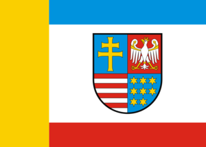
Holy Cross Voivodeship
- Profile
- Images
Date:
[unknown]
[unknown]
Location: [unknown]
Location: [unknown]
Profile managers:
Skye Sonczalla  [send private message], Tina Kobus [send private message], Poland Project WikiTree [send private message], and Slavic Roots Project at WikiTree [send private message]
This page has been accessed 897 times.

|
| Part of the Poland Project |
Contents |
General Information
- Official Website
- Capital: Kielce
- Population: 1,263,176 (2014) [1]
- Area: 11,672 km2 [1]
- "Holy Cross Voivodeship is situated in southeastern Poland, in the historical province of Lesser Poland, and takes its name from the Świętokrzyskie (Holy Cross) mountain range. Its capital and largest city is Kielce. Świętokrzyskie Province is bounded by six other voivodeships: Masovian to the north, Lublin to the east, Subcarpathian to the southeast, Lesser Poland to the south, Silesian to the southwest, and Łódź to the northwest. The province was created on 1 January 1999, out of the former Kielce Voivodeship, eastern part of Częstochowa Voivodeship and western part of Tarnobrzeg Voivodeship, pursuant to the Polish local government reforms adopted in 1998. It covers an area of 11,672 square kilometres (4,507 sq mi), making it the second smallest of the voivodeships (after Opole). As at 2006, the total population of Świętokrzyskie Voivodeship is 1,281,796."[1]
- Holy Cross Voivodeship was created out of the former Kielce Voivodeship, eastern part of Częstochowa Voivodeship and western part of Tarnobrzeg Voivodeship, pursuant to the Polish local government reforms adopted in 1998.

|
Historical Categories of Interest
Historically part of:
- Category: Piotrków (Province),
- Category: Kielce (Province) and
- Radom (Province) of Congress Poland, Russian Empire.

|
Historical Timeline
- 1385 - 1569 = Kingdom of Poland
- 1569 - 1795 = Polish-Lithuanian Commonwealth
- 1795 - 1814 = Austrian Empire
- 1815 = Freed during the Napolenoic Wars.
- 1815 - 1918 = Piotrków, Kielce, and Radom Provinces of Congress Poland, Russian Empire
- 1918 - 1919 = Following the end of World War I, the Greater Poland Uprising (1918–1919). 1918, Kielce Province was created.
- 1921 - 1939 = Second Polish Republic.
- 1939 - 1945 = Nazi Germany Occupation
- 1947 - 1952 = Republic of Poland
- 1952 - 1975 = Polish People’s Republic
- 1975 - 1998 = Part of Kielce, Tarnobrzeg, Czestochowa, Piotrkow and Radom Provinces. Polish People's Republic.
- 1999 - today = Republic of Poland
Administrative Divisions
| City County | Polish Name (Polish Language Category) | Seat | Total Gminas |
| Kielce | Kielce | Kielce | 1 |
| Land County | Polish Name | Seat | Total Gminas |
| Kielce County | powiat kielecki | Kielce County | 19 |
| Ostrowiec County | powiat ostrowiecki | Ostrowiec, Świętokrzyski | 6 |
| Starachowice County | powiat starachowicki | Starachowice | 5 |
| Jędrzejów County | powiat jędrzejowski | Jędrzejów | 9 |
| Końskie County | powiat konecki | Końskie | 8 |
| Sandomierz County | powiat sandomierski | Sandomierz | 9 |
| Skarżysko County | powiat skarżyski | Skarżysko-Kamienna | 5 |
| Staszów County | powiat staszowski | Staszów | 8 |
| Busko County | powiat buski | Busko-Zdrój | 8 |
| Opatów County | powiat opatowski | Opatów | 8 |
| Włoszczowa County | powiat włoszczowski | Włoszczowa | 6 |
| Pińczów County | powiat pińczowski | Pińczów | 5 |
| Kazimierza County | powiat kazimierski | Kazimierza Wielka | 5 |
Protected Areas
- Świętokrzyski National Park
- Chęciny-Kielce Landscape Park
- Cisów-Orłowiny Landscape Park
- Jeleniowska Landscape Park
- Kozubów Landscape Park
- Nida Landscape Park
- Przedbórz Landscape Park (partly in Łódź Voivodeship)
- Sieradowice Landscape Park
- Suchedniów-Oblęgorek Landscape Park
- Szaniec Landscape Park
Research Resources
- Geneteka
- https://metryki.genbaza.pl/; how to use GenBaza (PDF download): https://www.familysearch.org/en/wiki/img_auth.php/a/af/GENBAZA.pdf
- https://indeksy.net/news.php
- Cemetery: Findagrave Świętokrzyskie
- Cemetery: Grobonet Świętokrzyskie
- Cemetery: eCmentarze.pl
- State Archive in Kielce
- State Archive in Piotrkow
- State Archive in Radom
Photos

|
| Świętokrzyski National Park |

|
| Town Square of Sandomierz, Poland |
Sources
- Britannica, The Editors of Encyclopaedia. "Świętokrzyskie". Encyclopedia Britannica, Invalid Date, https://www.britannica.com/place/Swietokrzyskie. Accessed 8 November 2022.
Images: 4


Collaboration
- Login to edit this profile and add images.
- Private Messages: Contact the Profile Managers privately: Skye Sonczalla, Tina Kobus, Poland Project WikiTree, and Slavic Roots Project at WikiTree. (Best when privacy is an issue.)
- Public Comments: Login to post. (Best for messages specifically directed to those editing this profile. Limit 20 per day.)
Comments
Leave a message for others who see this profile.
There are no comments yet.
Login to post a comment.