
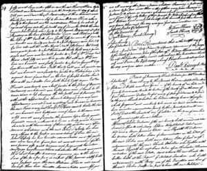
1803 Deed. William Hinds and wife to John Deputy
- Profile
- Images
Date:
16 Dec 1803
to
12 Apr 1804
Location: Cedar Creek Neck, Cedar Creek Hundred, Sussex County, Delaware
Surnames/tags: deputy hinds
Location: Cedar Creek Neck, Cedar Creek Hundred, Sussex County, Delaware
Surnames/tags: deputy hinds
This page has been accessed 121 times.
- Deed: William Hinds and wife to John Deputy [1]
- Date: 16 Dec 1803
- Recorded: 12 Apr 1804
- Location: Cedar Neck [2], Cedar Creek Hundred, Sussex County, Delaware
- Tract: 187 Acres
Deed
- This Indenture made the sixteenth day of December in the year of our Lord one thousand eight hundred and three, between William Hinds and Sarah his wife of the County of Sussex and State of Delaware of the one part, yeoman, and John Deputy of the same County and State aforesaid of the other part
- Witnesseth that the said William Hinds and Sarah his wife for and in consideration of the just and full sum of five hundred and thirty seven pounds ten shillings, current money of the State aforesaid, to them in hand paid the said John Deputy the receipt whereof we doth hereby acknowledge and of and from every part and parcel thereof Doth fully, freely and absolutely acknowledge and, of, and from, every part and parcel thereof Doth fully, freely and absolutely acquit, exonerate and discharge the said John Deputy his heirs, executors, administrators and assigns, forever.
- Hath, given, granted, bargained, sold, delivered, aliened, eneoffed, made over, confirmed and by these presents Doth give, grant, bargain, sell, deliver, alienate, enfeoff, make over, convey and confirm unto the aforesaid John Deputy, his heirs, executors, administrators or assigns, forever.
- Certain tract or parcel of land situate in Cedar Neck in Cedar Creek Hundred and County aforesaid; adjoining land of William VanKirk, William Davis, George McCay and Joseph Walton, it containing one hundred and eighty seven acres, it being part of a larger tract of five hundred acres taken up by a certain order; Johnson Dirkirk (VanKirk) of the County aforesaid and the said Art J Dirkirk (VanKirk) by his died of sale bearing date the fifth day of June 1704 sold to Thomas Himmons two hundred acres and the said Thomas Thomas Himmons by his died of sale bearing date the eighth day of March 1758 sold to Thomas Haynes two hundred acres of land which having reference to the Rolls Office for the County aforesaid willfully and at large make, assign, and the said Thomas Haynes (Hinds) by Last Will & Testament bearing date the twenty seventh day of April 1768, gave and devised the said land calling it three hundred and thirty five acres more or less to his son William Hinds who is party to the present and the said William Hinds by his contract of agreement bearing date the fourteenth day of December 1800 to the above named John Deputy who is a party to these presents;
- Beginning at a Post standing in the line of Joseph Walton land and running with the line of William Vankirk land South fifty two and a half degrees West one hundred and twenty six perches to a Post standing nine feet N.W. of a Red Oak with three notches, thence North fifty degrees, West twenty and a quarter perches to a Post, thence South thirty eight and a quarter degrees West, seven and two tenths perches to a Post of William Davis land, thence North fifty one and three quarters West with said William Davis line one hundred and sixty perches to a Post in George McCays's line thence with said line, North thirty eight and one quarter degrees East one hundred and seventy two perches to a Hickory being a old original corner of said tract in the line of Joseph Walton land, then with said Walton line South thirty eight degrees East two hundred and twenty and a half perches to the place of beginning, containing one hundred and eighty seven acres of land be the same more or less.
- Surveyed the fourth day of January 1804 with all the appurtenances thereunto belonging or in any wise appertaining and all Deeds weighing and evidence concerning the said land or any part thereof, To have and to hold, the aforesaid one hundred and eighty seven acres of land be the same more or less and all and singular the premises before hereby granted, bargained and sold, with them and every of their rights, members and appurtenances whatsoever unto the said John Deputy, his heirs and assigns to the proper use and behoof of him, the said John Deputy, his heirs, executors, administrators and assigns forever, clear and free of, and from, all and or of other and former gifts, grants, bargains, said Judgments, executions, mortgages and encumbrances whatsoever, the rents and services that shall here after be arising, engrossing due to the land or lands of the fee or fees for or in respect of the person or by except and foreprised and the said William Hinds and Sarah his wife, their heirs, executors, administrators and assigns and all and every other person or persons whatsoever claiming or pertaining to claim by, for, from under them or other of them , every person claiming or pertaining to claim or any wise whatsoever shall and will warrant and forever defend by virtue of these presents.
- In witness whereof the said William Hinds and Sarah his wife hath hereunto put their hands and fixed their seals the day and year first above written
- William Hinds (seal)
- Sarah Hinds (seal)
- Signed, sealed and delivered in the presence of:
- Dan'l Rodney
- Sarah Rodney
- Sussex County} State of Delaware }
- Be it remembered that on the twelfth day of April Amos Dom 1804, personally appeared before me, one of the Justices of the Court of Common Pleas of the State aforesaid, William Hindes and Sarah his wife, the grantors within named acknowledged this Indenture their act and deed. In testimony whereof I have hereunto set my hand the day and year above written.
- Daniel Rodney, JC
Images
- (1) 1803 Deed. William Hinds and wife to John Deputy
- (2) 1803 Deed. William Hinds and wife to John Deputy
Sources
- ↑ William Hinds and wife to John Deputy. 16 Dec 1803. Sussex County Records. Georgetown, Delaware. Deed Record Volume 24. Page 33.
- ↑ "Cedar Neck": neck of land. 4.5 miles long between the Mispillion River and Cedar Branch, 3 miles east of Milford; Sussex County, 38° 55' 00" N, 75°22'30" W.
- Page 26. Title: Delaware Place Names. Geological Survey Bulletin 1245. Prepared by United States Department of the Interior. Washington: 1966. (Accessed 20 Apr 2017)
Images: 2

Collaboration
- Login to edit this profile and add images.
- Private Messages: Send a private message to the Profile Manager. (Best when privacy is an issue.)
- Public Comments: Login to post. (Best for messages specifically directed to those editing this profile. Limit 20 per day.)
Comments
Leave a message for others who see this profile.
There are no comments yet.
Login to post a comment.