In this image:
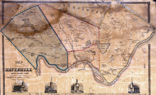
When: 1851.
Uploaded: 30 Mar 2020 by Adrian Stanley.
Comments: 2, WikiTree Popularity: 1.
Original digital image: 3500 x 2146 pixels. Adobe Photoshop CS4 Windows software. Dated 2020:03:30 15:48:09.
SAUNDERS SAUNDERS SAUNDERS SWETT SAUNDERS
Do you love this photo? Maybe it's just interesting, or there's a story behind it? Please share it with the WikiTree community.

This image is open for viewing but you need to be logged in to edit the details. Please login here.

I have placed a red X at the approximate location, on the Map, as given above.
https://archive.org/stream/historyofhaverhi61chas/historyofhaverhi61chas_djvu.txt
edited by Adrian Stanley
Contributor Names Walling, Henry Francis, 1825-1888. Jaques, A. B. Published by A.B. Jaques, 1851.
https://www.loc.gov/resource/g3764h.ct006245/?r=0.745,0.105,0.216,0.075,0